Sep-Oct 2012, Nevada Backcountry Bicycle Tour
All content copyright © 2010-2024 Frank Revelo, www.frankrevelo.com, United States copyright office registration number TX-7931345
Planning
Current guide to maps for a trip like this is here. This guide will be updated as time passes, and so may not reflect what I actually used on this trip, which was a combination of: (a) pages from the Nevada and Utah Benchmark Road Atlas; (b) 100K topo maps on my Garmin Etrex 20 mapping GPS; (c) offline Navteq road maps on my Nokia N8 smartphone.
Equipment changes/maintenance since previous bike tour
- Oil change.
- Cleaned/lubed chain.
- Toothbrush and bottle of citrus chain cleaner added to bike repair/maintenance kit.
- Cloth rim strip to replace original nylon rim strip and then rubber replacement rim strip.
- Extra opsaks.
- Sand stakes in addition to regular nail stakes.
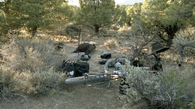
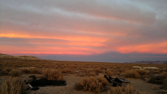
Tue, 11 Sep 2012 (28 miles in 4:16 hours)
Starting odometer 2115 miles.
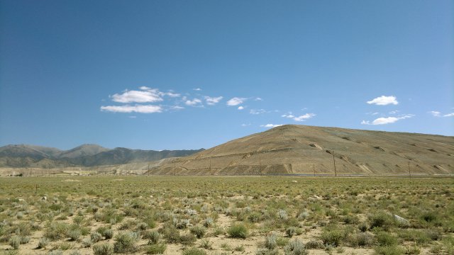
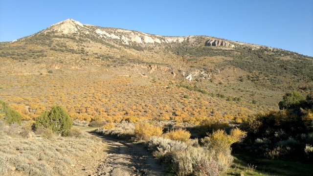
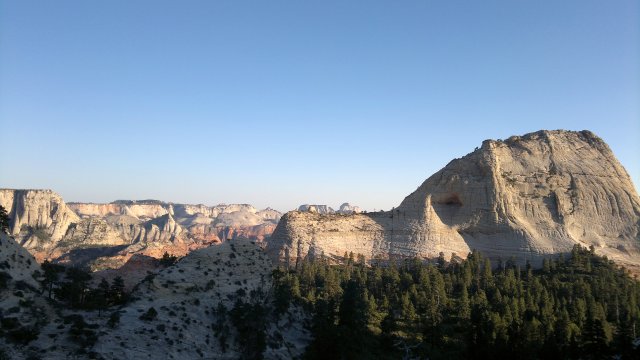
Took the dirt road (as described in the march/april trip report here) from Reno to Virginia City. Didn't eat breakfast, didn't stop even once to rest or snack, just a few pauses to drink water, and yet made it to Virginia City without feeling tired. Granted, I didn't weigh the bike down with water like I did back in March, but still, I'm evidently much stronger now than then. Some misgivings about this Sept 11 start date, as sun is intense and days long. At least they will be getting shorter as time passes.
Visited the "As It Was" museum. Motel room at Comstock Lodge was $61 including tax. Chi-chi furniture, full bath with tub and quiet, but no wifi. Virginia City motel quoted $88 on phone (versus $61 including tax I paid back in March). Bought some snacks at Sugarloaf Motel.
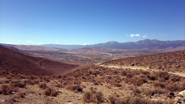
looking back at south reno, from dirt road to virginia city
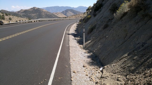
geiger grade, between lousetown road and virginia city, note the narrow shoulder and blind curve
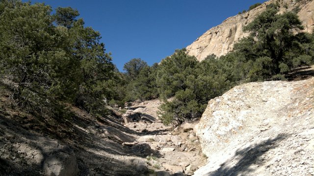
Wed, 12 Sep 2012 (44 miles in 6:03 hours)
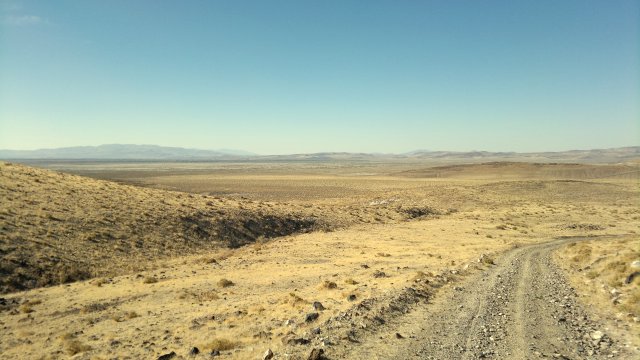
Six Mile Canyon road, Fort Churchill road, Highway Alt 95 to get across Carson River (which was mostly dry at this point due to the drought and it being late in the year), Simpson road to Hooten Well, then the powerline road south. According to map, powerline road will take me to Julian Lane, which parallels Walker River to Schurz. Powerline road alternates between very rugged hardpack and deep sand, so that I had to push much of the way. Not a good road for bicycles. Camped along this powerline road.
Lack of shade here in the desert very noticeable compared with my recent tour in the Lassen national forest, where there were trees everywhere. But there are compensations: few insects (just a few flies), no pine sap, quiet (little wind this time of year), solitude and magnificent views.
looking back at hooten well
Thu, 13 Sep 2012 (50 miles in 6:51 hours)
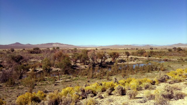
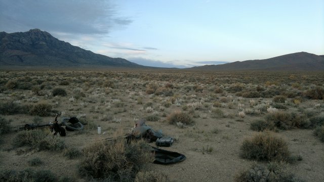
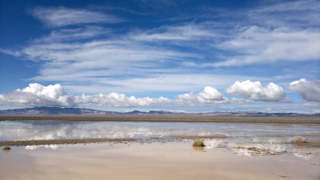
More pushing along the powerline road due to deep sand. Julian Lane much better. Then a variety of small roads to get to the tribal services buildings in Schurz, where I refilled my water bladders from an outdoor faucet. Bought some bread, cheese and snacks at the small convenience store 1 mile south of highway 95 / highway Alt 95 intersection. Rested and ate at a picnic table shaded by a trellis. Motel across the highway, but it wasn't clear whether it is open or not. Then took the dirt road that runs from Schurz towards Red Ridge and then towards Rawhide, which is mostly solid, though I had to get off and push in a few places due to sand. Camped in the vast and desolate Rawhide Flats valley. Absolute quiet at night due to lack of wind.
walker river, as seen from julian lane
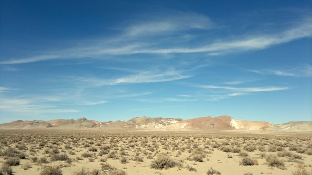
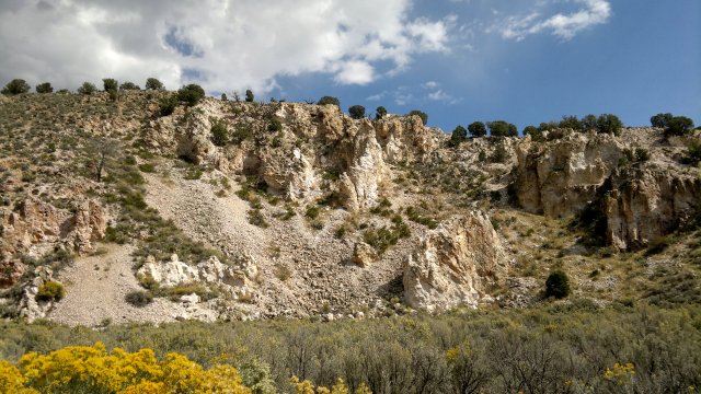
calico hills, as seen from dirt road between schurz and rawhide
Fri, 14 Sep 2012 (48 miles in 6:39 hours)
Both road atlas and Garmin maps are out-of-date near Rawhide, since the old road has been replaced with a detour slightly to the north, to allow expansion of the huge mine at the site marked National Mine. New road merges with old road east of the mine. Then highway 839 north to Little Bell Flat road, then north to highway 50, taking the diagonal variant shown on the road atlas map to get a little closer to Middlegate, then a few miles on highway 50, and finally the dirt road cutoff to Middlegate. All these roads are solid gravel.
$30 for room at Middlegate motel. Ate dinner in the bar. Same limited selection of foods in the mini-mart. Internet working fine. I'm riding longer days than I'd prefer, but nowhere shady to rest during the day, so I might as well ride and get the benefit of a breeze that way. I might need some cloth gloves to protect my hands from the relentless sun. Experimented with cleaning the chain at the motel. 250ml bottle of chain cleaner is probably overkill, but I don't want to reduce to 125ml until I have more experience. Better to err on the side of too much than too little.
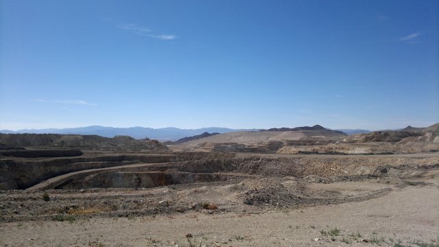
working mine near the old rawhide site
Sat, 15 Sep 2012 (44 miles in 5:17 hours)
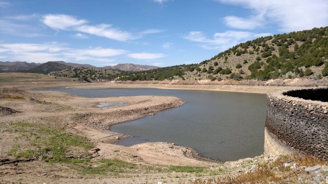
Breakfast at the Middlegate bar. Highway 50 east, then Eastgate cutoff, then Buffalo Summit road to Ione. I had planned to eat at the bar there, but one of the few year-round residents informed me that the bar had been closed for years. Supposedly, the former owner hired no-accounts to work for him, and these drank up all the liquor and stole money from the cash register, so that the bar was very unprofitable, but at least it was lively while it was open. Town mostly deserted, but houses are maintained as weekend/vacation homes. Major fiber optic cable runs though town (since road here is the easiest pass through the mountains), so there is good telephone and internet service available. No electricity, but solar power works fine. Water from 1800' well, which is pumped to tank and then gravity feeds town. The resident I spoke to, a former heavy-equipment operator who worked on the installation of the fiber optic cable, has a small greenhouse to produce vegetables even in cold weather. Town used to get 4 feet of snow in winter, but nothing this year due to the terrible drought. Filled my bladders from the outdoor faucet at the town park. Decided to postpone visiting Berlin-Ichthysaur State Park for another trip, since it was late in the day and I wanted to camp near a summit, so as to save my climbing strength tomorrow for the Ophir Summit ascent. So took the Ione pass road and camped near the summit.
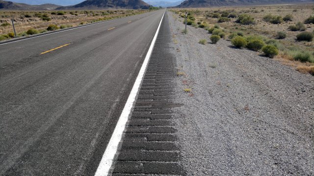
highway 50 near middlegate, note how rumble strip extends across entire shoulder, which isn't that wide to begin with, making it extremely uncomfortable to cycle there
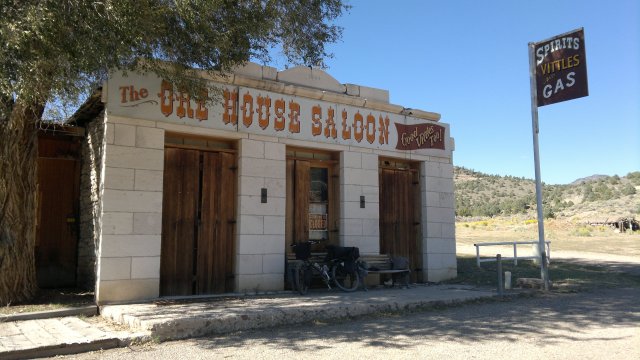
ione bar
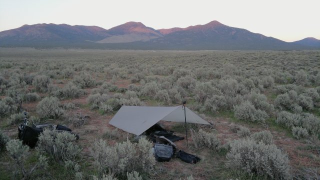
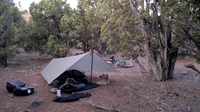
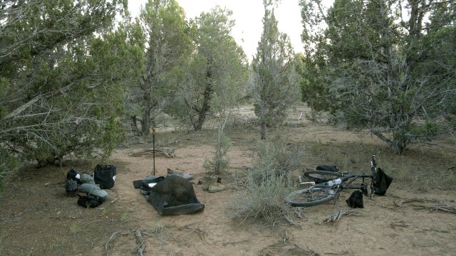
campsite near ione summit
Sun, 16 Sep 2012 (36 miles in 5:52 hours)
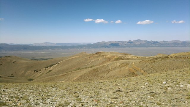
Pushed the bike much of the way up to Ophir Summit (10109 feet elevation) due to the steep grades, then had walk the bike most of the way down, due to the even steeper grades (30% in places, and 20% overall, since there is 4000' of descent over about 4 miles) and sheer ruggedness (the Garmin maps more accurately describe this "road" as a trail). This eastern side of Ophir Summit road is the worst road I have yet encountered during my bike tours. Much worse than the Lippincott road from my first Death Valley tour. Even a jeep would have trouble on this road, due the boulders everywhere from rocks falling off the mountain slopes above. I had quite a bit of difficulty controlling the bike while walking it down due to the steepness and these boulders, even though the bike was only lightly loaded with food and water. Pushing a heavily loaded bike up this road would be extremely difficult. The former heavy equipment operator in Ione had warned me about this road. However, this is the only road across the mountains here. The alternative would be to use the Cloverdale and Peavine Creek roads to circle south of the mountains.
Ophir Summit is windswept and bare of trees, so would make a lousy campsite. It might be possible to camp near the little creek (with running water even in this drought year) which I passed on the way up, or near the old mines on the way down (and there is also running water at various spots on the way down).
After descending from Ophir Summit, took highway 82 south to Carvers, where there are a variety of bars and cafes, a hardware store, some motels which cater to mine workers, and the well-stocked Shoshone Market convenience store and deli, which I bought a sandwich and some snacks for dinner. Camped in the sagebrush outside of town. Highway 82 has no hard shoulder, but traffic is light, sightlines are open, and soft shoulder is hardpack gravel, so not a very dangerous road.
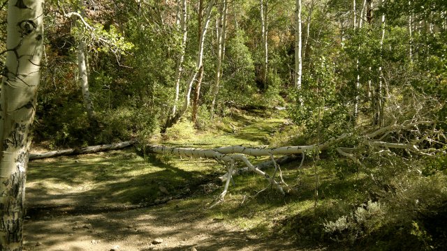
creek and aspen grove on road to ophir summit
looking west from ophir summit
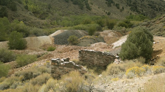
site of old murphy mine, on way down from ophir summit
Mon, 17 Sep 2012 (48 miles in 5:20 hours)
Took highway 82 about 11 miles south to Hadley, which is where most of the residents of the old town of Round Mountain were relocated after being bought out, to allow expansion of the huge mine there. A few residents remain in the old town, hoping to extract more money from the mine operators before moving. Store in Hadley is very well-stocked and reasonably-priced, so it is possible to perform a full resupply here. This is significant, because the next resupply point will be a week away in Preston/Lund. Hadley also has a very nice library with wifi, open everyday except Sundays, and a garden with shaded picnic tables and water faucet outside the library. Researched Belmont at the library, to see whether there would be water there or not. Information was inconclusive, so I loaded up just in case, along with a week's worth of bread and cheese. Bike feels very heavy when fully loaded like this (10 kg gear, 23 kg water, 7 kg food), but not a problem as long as the road is paved or solid gravel. Pushing such a heavily loaded bike up Ophir Summit, on the other hand, would be impossible, at least for me.
Took the highway back north to Toquima range road then the Moore's creek road heading east through the mountains. Both of these are solid gravel, and I had no difficulties pedalling the heavily loaded bike uphill. Camped in the sagebrush along Moore's Creek road.
massive round mountain tailings dump
Tue, 18 Sep 2012 (51 miles in 6:25 hours)
Took the dirt roads south to Belmont, passing but not stopping at Pine Creek Campground on the way. As it turns out, Belmont has quite a few year-round inhabitants, so there was no need to tote all that water from Carvers. One of the residents assured me that the spring in the middle of town was good for drinking, and indeed it tasted delicious. He also assured me that Pine Creek campground had year-round water from a mountain creek, even in a drought year like the current, and several RVer's who had just been at the campground confirmed this information. Had to push the bike the last mile to Barley Creek Summit, then walk a mile down the other side due to steepness, but certainly nothing like the Ophir Summit road. I had discussed this road with the Belmont resident, who has explored the area extensively on ATV's, and he assured me that Ophir Summit road on the east side was indeed the worst road by far in these parts. Passed lots of green meadows on the descent from Barley Creek Summit, so evidently there is water running underground, which should eventually emerge in a stream. Camped amid pines a few miles down from the summit.
along moores creek road
belmont courthouse in background and spring in foreground (fed by black hose and emptying between the two boards)
Wed, 19 Sep 2012 (42 miles in 5:45 hours)
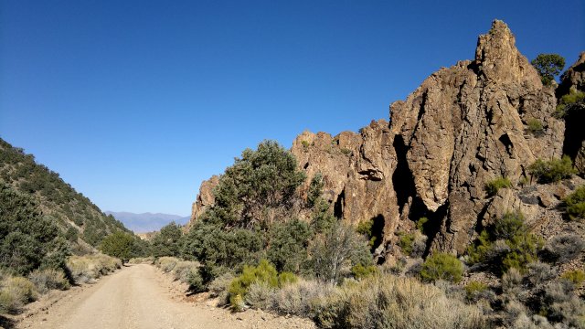
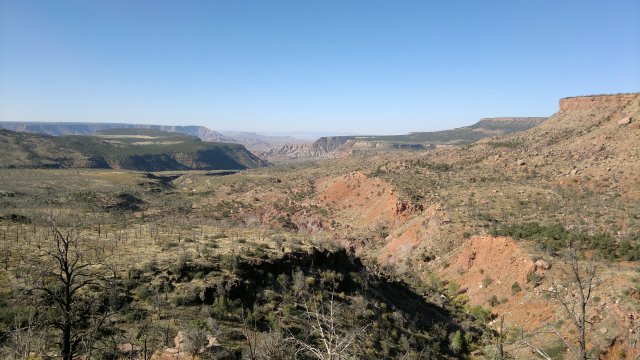
Used the eagle pass road to get from west to east stone cabin valley. Very rugged road in places, more like a stream-bed, though probably passable with a jeep. And less steep than Barley Creek Summit road, so not at all difficult with the bike, though I had to push rather than pedal due to the ruggedness. Hot Creek Canyon road is private and gated (6 gates, in fact), but owners allow thru-traffic during daylight hours, subject to the typical rules: close the gates, no hunting, no shooting, no camping. There is water running in the canyon. Both road atlas and Garmin 100K maps are misleading when it comes to Lower Hot Creek Ranch, as they show the main road from the south passing straight through the ranch (which is gated private property) rather than around it. The correct route for someone emerging from Hot Creek Canyon and wanting to head north is thus to continue south for about a mile past the ranch gate, then turn left (east) onto a good gravel road, which soon bends north and passes the other gate to the ranch. Camped in Jumbled Rock Gulch. Rocks didn't seem more jumbled there than elsewhere.
old daugherty ranch
eagle pass road, four-wheel-drive only
old dugan ranch
Thu, 20 Sep 2012 (51 miles in 7:00 hours)
Road across Big Sandy Valley solid at first, then the valley lived up to its name and I had to get off and push due to the sand. Of about 12 miles total, pushed for about 4. Also pushed in various other spots along today's route. Picked up water from outdoor faucet at Duckwater Tribal Center. Camped in the sagebrush a few miles before White River Pass canyon. Lots of wild horses in the area.
white pine range, with wild horses in foreground
Fri, 21 Sep 2012 (46 miles in 7:18 hours)
Both road atlas and Garmin 100K maps show an old road running through the mountains via White River Canyon, but this was overgrown and eventually reduced to a narrow hiking trail. Sagebrush was so close on either side of this trail that getting through on a bike would have been very difficult, and who knows how bad things would get once I began to ascend into the mountains. Though I don't much care for motorbikes and ATV's, due to their noise and the hoodlum-like behavior they encourage, I am definitely grateful for pickup trucks and jeeps for keeping these backcountry roads open and packed solid.
Backtracked and decided to take the Cathedral Canyon and Hamilton-Pioche stage route through the mountains. Road atlas and Garmin 100K maps are misleading again here, as county route 5 has clearly been rerouted to fork right at Black Point to get to Green Springs ranch, rather than continuing to Bull Creek Reservoir before turning right. I was able to open/close the gate at the reservoir, though with difficulty. Cathedral Canyon road completely washed out in places, so only passable with bicycles or motorbikes. I had to descend and push much of the way, due to the ruggedness. I had neglected to fill my bladders completely at Duckwater, since I hadn't expected to take this longer route. This was a mistake. It is always best to bring extra water when traveling in the desert. Fortunately, I was able to pick up some more water at the excellent Six Mile spring, which flows from a rock wall. Camped not far from this spring. Spotted some elk on a ridge above the spring in the evening.
old green springs ranch
near six mile canyon spring
Sat, 22 Sep 2012 (37 miles in 4:37 hours)
Checked into the Lanes Ranch Motel, along highway 318 near Preston. $46, including tax, for nice room (full bath, 2 double beds, microwave, refrigerator, TV, very clean and roomy). Ate the last of my food for breakfast, but convenience store which is part of Lanes truck stop complex had enough supplies to get me to Ely. No wifi at motel, but did pick up ATT 3G connection, so able to check weather. Possible shower tonight or tomorrow. Having seen the washed out roads through Cathedral Canyon makes me respectful of the power of desert rainstorms. Need to start carrying an extra couple days food to allow going into hibernation during periods of extended rain plus however long it takes for the roads to dry out after the rain.
along ellison creek
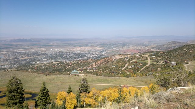
egan range, with town of preston in the foreground
Sun, 23 Sep 2012 (51 miles in 5:47 hours)
Bike dripped some crud on the motel carpet. Did my best to clean it up. Need to be more careful about that. In a remote area like this, I could have simply left the bike outside, locked to a post with my flimsy cable lock. However, I dislike having separate procedures for different situations and prefer to always do things the same conservative way regardless, so as to minimize mistakes. This is why, for example, I always attach the keeper cord to my hat, even if just putting it on indoors and planning to take it off before going outdoors, because there is always the possibility that something will happen so that I forget and go outdoors, in strong winds, without the keeper cord attached and lose the hat while crossing a bridge. And so on.
Took Sawmill canyon road across the Egan Range. Then a brief visit to the Ward Charcoal Ovens. Well worth the detour, which I hesitated about due to the impending rainstorm. Arrived at Motel 6 just as the rain began to fall. $48 including tax for a room that was run-down and smellier than the typical Motel 6. These negatives compensated for by free wifi (rather than the usual $3/day fee) and a sink with good water flow rather than water-saving sprinkler. Feasted on food from the nearby grocery. Other cheap motels in Ely are quite a walk from the grocery.
sawmill canyon
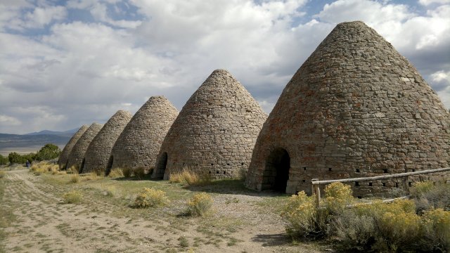
ward charcoal ovens
Mon, 24 Sep 2012 (0 miles)
Rained all day, so paid for another night at the motel. Walked around town a bit to stretch my legs, protected by my poncho. Read the newspapers in the public library. Sportsworld sporting goods store has a decently-stocked bicycle department with repair shop.
Tue, 25 Sep 2012 (45 miles in 5:47 hours)
Sunny skies and cool temperatures in the morning, then cloudy, but no rain other than very light sprinkle near Cooper Summit. Took dirt roads from Ely through Steptoe Valley wildlife management area, then paved road to Cave Lake, then dirt road through cooper canyon, then highway 893, then highway 6/50, and finally Oceola road. Snow visible on the high peaks of the Snake range. I was pleasantly surprised by how dry the dirt roads were, given the heavy rain yesterday. A few puddles where the roads ran through depressions, a few slick spots, but othewise everything was solid. This alleviates one of my main concerns about backcountry traveling, which is the possibility of being stranded for long periods by muddy roads. Camped along Oceola road. Erected the tarp in case of further rain.
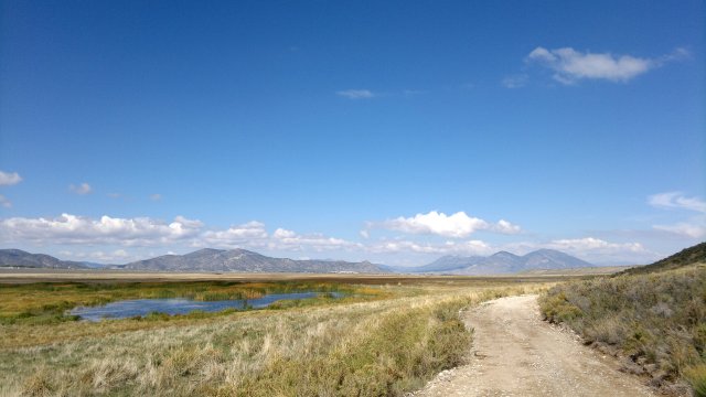
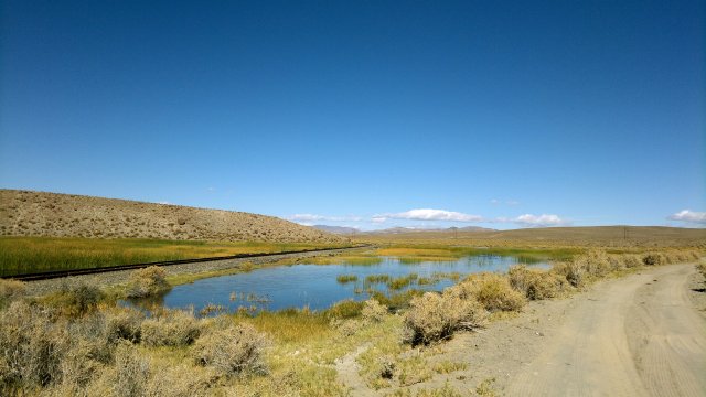
ponds in the wildlife management area, with ely in the distance
view from cooper summit
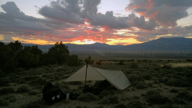
camp along osceola road, wind farm in the distance
Wed, 26 Sep 2012 (41 miles in 5:02 hours)
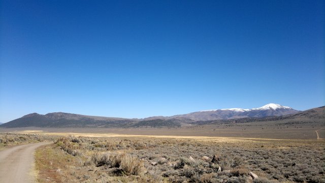
No rain, but heavy dew on the tarp in the morning. Continued along Oceola road, then Weaver creek road, then old highway 6, and finally some dirt roads shown on the Garmin 100K maps but not on the road atlas maps to get to Baker Archeological site. Not much to see there, but a nice brochure is available for reading. Loaded up on water at the Great Basin National Park Visitor center, and viewed the exhibits, but didn't feel like sticking around another day to visit Lehman cave. Bought some food for lunch at one of the two small grocery stores in town and ate outside at a picnic table. There are also two motels in town, plus Border Inn motel and convenience store a few miles away on highway 6/50. Camped along Garrison-Black Rock road, my first night in Utah.
mount wheeler, white on top from recent snow, as seen from weaver creek road
near garrison, utah
Thu, 27 Sep 2012 (60 miles in 6:25 hours)
Dew again in the morning. Followed Garrison-Black Rock road, then Pine Valley road south. Mostly hardpack and dry, other than a short stretch where roadbed lower than surrounding plain, where the ground was still muddy. Luckily, the surrounding plain had little vegetation, so I was able to walk the bike around these muddy stretches. Camped along Pine Valley road.
wah wah mountains
camp in sagebrush
Fri, 28 Sep 2012 (41 miles in 5:27 hours)
Lots of visitors last night. First, a cow viewed me suspiciously from a distance and bellowed for about ten minutes to the other cows before the herd finally moved on. Then some wild horses came by to inspect. They ran off when I kicked the tarp and roared. Finally, a burro stood nearby and alternated for half an hour between braying and listening to another burro braying in the distance. Unlike horses and cows, who hang together in herds, burros prefer to be solitary but stay in communication with their fellows by such loud braying. Roaring and kicking the tarp didn't seem to faze the creature and I was too lazy to get out and throw a rock at it. Finally, it shut up and wandered off.
I didn't want to get to Cedar City until tomorrow, so killed some time today by taking a loop through the mountains before camping near Bible Spring, in the juniper covered hills at the south end of Pine Valley.
cliffs along pine valley road
camp among junipers
Sat, 29 Sep 2012 (50 miles in 4:43 hours)
Tarp finally dry this morning. Followed Lund highway (gravel road) to get into Cedar City. Checked into Value Inn ($40 including tax). Real stinker of a motel. Wifi too slow to be of any use, air vent allowed me to hear every word being said in room next door, everything run-down and crummy, and then finally I felt bedbugs crawling on me when I turned off the light to go to sleep. I turned the light back on and there they were, adult and nymph-size bedbugs all over the pillow. I hung my gear to prevent any stowaways, then deployed my bugbivy as protection.
According to yellow pages, Cedar City has two bike shops, both south of downtown, either on or just off Main Street: CedarCycle.com (435-586-5210) and Bike route (435-586-4242).
Sun, 30 Sep 2012 (41 miles in 5:22 hours)
Didn't sleep well, but at least the bedbugs weren't able to get to me. Problem I faced in the morning was how to ensure no bedbugs remained on the bugbivy, since both the bugs and the bugbivy are black and thus the bugs are hard to see, especially the tiny nymphs. Decided to soak the bugbivy in hot water in the tub, and that indeed seemed to kill them off. I wasn't too upset by this bedbug incident, since I had long been wanting to test such a scenario. In this case, I could have simply asked for another room or moved to another motel, but that might not always be possible, so I want to be prepared.
Heavy traffic for first 5 miles along Cedar Canyon Road, then moderate traffic after I turned off at Right Hand Canyon road and began the 4000' ascent to Kolub plateau. Pedalled the whole way using first gear, 10% grade typically. I am indeed getting stronger. Kolub plateau is scenic, but I didn't much care for the barbed wire fences and "no trespassing" signs on either side of the road, so that there was no place to stop and take a lunch break away from the traffic. Same cramped feeling as in Britain. Nor did I much care for the traffic, even though it was moderate and polite. I've been completely spoiled by the solitude and openness of the Nevada backcountry, since most roads in the United States are like this: moderate to heavy traffic, fences everywhere. Lots of vacation houses and "for sale" signs. What's the point of owning one of these vacation houses in an area that is snow-covered most of the year (9000' elevation) and where you can't even walk around due to all the fences?
Fences finally ended when I entered Zion National Park. Stashed the bike in a wooded area near wildcat canyon trailhead, then walked several miles along the North Peak trail, which terminates in a viewpoint of the famous rock formations. Camped where I had stashed the bike.
cedar highlands mansions
pastures on kolub plateau, scenery reminiscent Britain's Pennine Way: barbed wire fences everywhere (in Britain, the fences would be stone with barbed wire on top), sheep (small white spots barely visible in reduced scale photo), not too many trees (in Britain, there would be no trees)
view from north peaks trail in Zion National Park
Mon, 1 Oct 2012 (44 miles in 3:48 hours)
Didn't notice any bedbugs on me last night, so evidently I cleaned them all off by washing the bugbivy in hot water. Really, the simplest way to deal with bedbugs is to ask to see the room before paying and check for bedbug smell (best to do this on an empty stomach, so the sense of smell will be most acute). In fact, I did notice such a smell at the motel when I first entered the room, but I ignored my intuition. Bedbug smell is familiar to me, since I once stayed in a flophouse hotel in Marseilles, France which was absolutely infested with bedbugs, though curiously they didn't attack me. Perhaps this was because the man in the adjacent room was more appetizing: a ghostly-pale and grotesquely-obese alcoholic, who I spotted through his half-open door sitting buck-naked on a small chair cackling and sharing a bottle of cheap wine with a fully-dressed friend. When I left the hotel early the next morning, there were Africans sleeping on the floor everywhere, even on the stairs.
This bedbug incident points up the value of having gear that is fully washable. Right now, the quilt and insulated pullover are not easily washable, due to very tightly knit shell fabric treated with water-repellent finish. The fabric isn't waterproof, but it impedes water circulation enough to make washing difficult. Tightly knit shell fabric is required for down and perhaps short fiber synthetics, but not for continuous fiber synthetics (Polarguard family), which is what I use. Unfortunately, all the very lightweight nylons at the fabric stores are tightly woven and water-repellent.
Flat rear tire on the way to St George, from a nail on the highway. Removed tire and found the inside coated with spilled sealant from the leak. Big chunk of sealant solidified in the inner tube. Not sure whether it solidified just now due to the puncture or whether the solidification has been gradual ever since I installed the sealant a little over a month ago. This raises the question once again of whether to install sealant in advance, in anticipation of goathead thorns, or whether to wait until the goatheads are encountered before installing. Fixed the puncture with a patch, refilled the tube with sealant, remounted the tire. Got my hands dirty from the chain in the process. Cleaned them with citrus chain cleaner followed by rinsing with water. A good reason to carry extra chain cleaner on long trips. And being able to rinse is a good reason to always carry a full water bottle, even in the city, which is something I haven't always been doing. Whole day was on paved roads. Tiresome. I knew this area would be a congested tourist hole, but I wanted to see it, and now I have. I'll be back in the emptiness soon enough.
Checked into Economy Inn in St George ($41 including tax). Large suite with full kitchen, sofa and TV in living room, another boob tube in the bedroom, full bath. Of course, everything was tattered and rundown-looking and stinking of cleaning perfumes. But no bedbug smell that I could detect. Solid cinderblock walls, so hopefully not noisy like that hellhole in Cedar City. Wifi worked but only erratically.
north creek canyon
Tue, 2 Oct 2012 (0 miles)
Decided to take another zero day. Plan was to walk around town and sightsee, but lost interest and ended up spending the whole day alternating between the public library and the nearby grocery store. How I love yogurt and premium chocolate!
Several bike shops in St George: Bicyclesunlimited.com (435-673-4492), Bike Fix (435-627-0510), Red Rock Bicycle (435-674-3185). I stopped in at Bicycles Unlimited and they seem a pretty competent shop. A customer had brought in a Surly Pugsley to have the chainwheel replaced so as to get a lower first gear ratio. I spent a long while looking this beast over. 3.7" Endomorph tires on Large Marge rims with a Shimano 11-speed Alfine internal gear hub. Should work better than my Nomad in sand, but I wouldn't trade for it.
Wed, 3 Oct 2012 (40 miles in 4:52 hours)
Getting out of St George was as stressful as getting in. Typical sprawled-out American city, little provision for bicycles, motorists impatient and inconsiderate. Plus, this is a retirement mecca, so lots of older drivers with poor vision, poor muscular control, possibly senile and thus about as emotionally mature as a two-year-old child and God forbid anyone should take away their driving privileges. Took Highway 8 to Shivwits Indian Reservation, then misread the road atlas map regarding the Motoqua Road due to a crease in the Aloksak I used to protect the map. Garmin 100K maps contributed to the problem by, as usual, failing to distinguish minor from major roads and having other errors. Anyway, took the Gunlock Road north, stopping in at Veyo for a snack. Picked up a slew of goatheads during this detour to Veyo, but no flats, though I did have to pump up the rear tire a bit. So either the goatheads didn't cause punctures before I pulled them out, or the sealant did its job in fixing the punctures. Then backtracked and proceeded north along Veyo Shoal Creek road, camping along the same.
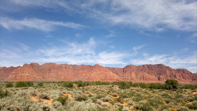
red cliffs near shivwits indian reservation, typical of scenery near St George, Utah
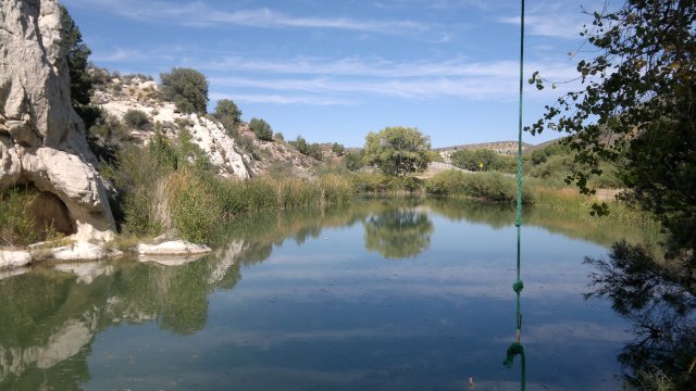
pond (and evidently swimming hole as well) north of gunlock
Thu, 4 Oct 2012 (48 miles in 6:13 hours)
Camp blissfully quiet in the morning. In fact, due to the lack of wind, most of my campsites have been blissfully quiet, other than that incident with the braying burro. What a change from all that traffic on the way out of St George! Though the motel in St George itself wasn't noisy, and the tidy Mormon town square was quite peaceful in the evening. It was also nice being able to eat fresh food from the grocery store.
Continued along Veyo Shoal Creek road to Crest line road, then west along the latter, then southwest along Enterprise road, Beaver Dam road, crossing the railroad near Barclay. Took Bunker Peak road by mistake instead of Fife road, but then turned west near Wood ranch to correct the error rather than backtracking. Camped before Pine Canyon Reservoir.
lower enterprise reservoir
another camp among junipers
Fri, 5 Oct 2012 (41 miles in 5:44 hours)
Caught up with Fife road after Pine Canyon Reservoir, then Barnes Canyon road into Caliente. Filled up with water at the town library (wifi not working), bought supplies at the grocery, ate at a little park. Several motels in Caliente, but I wanted to camp, and so ascended back into the mountains via Antelope road. Camped near Grey dome.
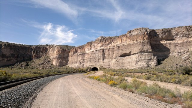
railroad tunnel near caliente
Sat, 6 Oct 2012 (37 miles in 5:10 hours)
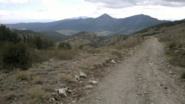
North towards Bennett Pass, then Pan-American road, and finally paved road 320, then highway 93 south to Pioche. Several motels in town, but I wanted to camp again. Bought supplies for 4 days at the store, ate in the town park, loaded up with water from a faucet there, then backtracked to where Stampede road heads west from road 320. Camped a few miles down Stampede road from this intersection. Lots of deer hunters heading out on their ATV's.
highland range west of pioche
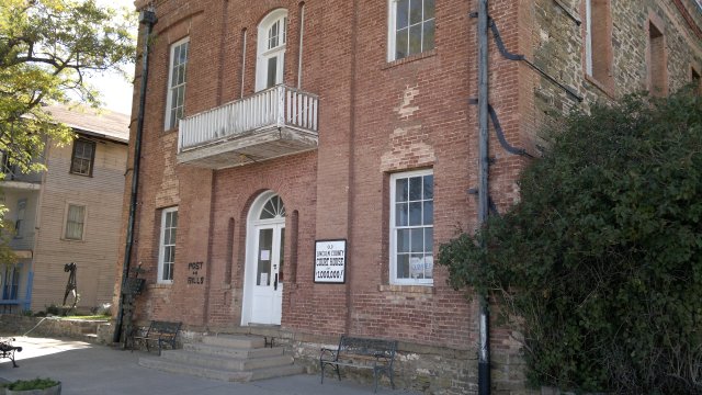
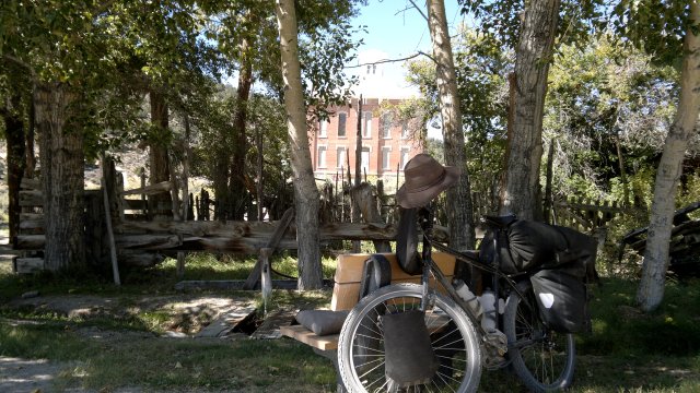
pioche's famous "million-dollar" courthouse
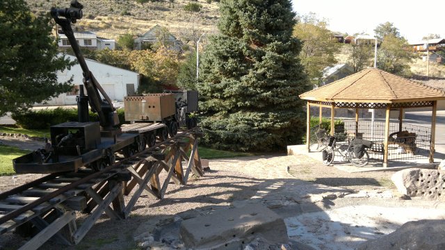
pioche heritage park
Sun, 7 Oct 2012 (46 miles in 6:01 hours)
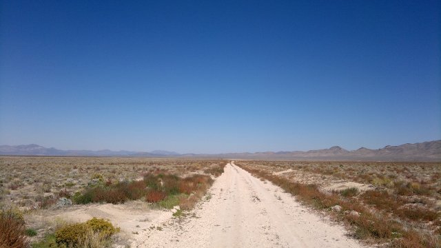
West on Stampede road, north on Live Water road, minor unnamed roads to get to Sunnyside road, a short stretch north on Highway 18, then west on Timber Mountain Pass road. Named roads are solid gravel, some sandy stretches along the minor unnamed roads.
Many huge steel powerline supports lying along Live Water road. Talked to a truck driver camped out along Sunnyside road, who said these were part of a transmission line to bring electricity to Las Vegas from a coal-fired power plant near Ely. Whole valley had been busy last year with workers erecting these towers, but then the towers started falling, so they had to be dismanteled until the design flaw was fixed. Man was living in a converted semi-trailer truck, along with a girlfriend. Semi-trailers have huge carrying capacity, but are designed primarily for paved roads. Said he had a hell of a time getting down Sunnyside road to where he was parked, and didn't know what he would do if he got stuck in the sand. Girlfriend receives a pension, whereas he is still several years from being eligible for reduced Social Security at age 62. Hoping to get a job driving trucks for the powerline like he did last year, though also says he is tired of working. These facts about his personal finances came out as part of a rant about gold. I noticed he had a big gun strapped to his side. He explained that he strapped the gun on when he saw me coming from far away.
Conversation lasted longer than I would have preferred. Being crazy and obsessed by gold and otherwise stupid about money are luxuries I can't afford, as I still have investments to manage. Hence I can't spend too much time listening to crazy and stupid people lest I end up like them. As it is, I can detect my mind withering away the longer I spend traveling in the middle of nowhere. It is as though I am turning into an animal. Is that so bad? The yogis praise this state wherein the mental chatter is silenced, yet I wonder as to its effects on my ability to cope with civilization. And as long as I have those investments to manage, cope with civilization I must. Indeed, I'll still need some wits about me even after I go on Social Security. Perhaps this quieting of the conscious mind is not the cessation of mental activity but merely a submerging of such activity into the subconscious, so that I still know what to do and how to do it, only I can't verbalize what I am doing and why. Then again, along with things I can afford to forget, like other people's names and big words, I find myself forgetting computer passwords and my own address and phone number. It's one thing to know when to manage my finances or find my way through the mountains without being able to verbalize what I am doing and why, but in the case of something like a computer password, verbalization IS the action.
Baby Joshua trees growing in the desert here. Perhaps a sign of the climate warming enough for them to migrate gradually north. Camped before Timber Mountain Pass.
live water road
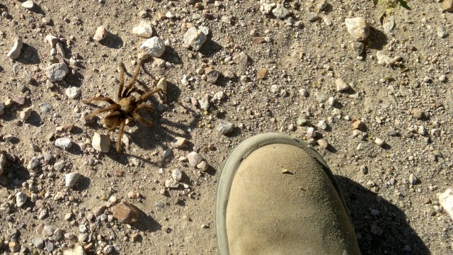
tarantula
Mon, 8 Oct 2012 (68 miles in 7:56 hours)
Timber Mountain Pass road, Cherry Creek road, detour (shown on road atlas map) to Adaven road to get around Cherry Creek ranch, ascent to Cherry Creek Summit, descent to Railroad Valley, west and then north towards Lunar Crater. Hit a strong headwind upon reaching Railroad Valley. First nasty wind I've faced this trip. Camped near Buttes Spring. Water flowing in Cherry Creek, but polluted from cows everywhere. Doesn't matter, since I still have plenty from Pioche and can pick up more at Hot Creek. Food is the limiting factor, since I didn't buy enough in Pioche, which is why I pushed myself hard today.
camp before timber pass
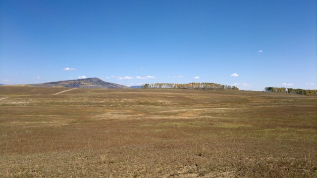
coal valley
uhalde ranch
Tue, 9 Oct 2012 (61 miles in 7:09 hours)
Wind gone in the morning, but picked up as the day progressed. South wind mostly, and thus a cross-wind for me. Had to push for a few miles near Buttes Spring, then the road firmed up and I was able to resume pedalling. Road badly washboarded from Lunar Crater to the highway due to all the summer tourist traffic. Much quieter this time of year. No one at the crater when I was there and only one car passed me as I was heading away from it. Picked up water at the cattle trough fed from Rattlesnake spring. The water looked and smelled clear and comes from a hose, but I'm not sure as to the source that feeds this hose. But probably okay. Crossed Hot Creek Valley. As noted before, to get around Lower Hot Creek Ranch, it is necessary to go south a mile or so, then north a mile or so, rather than passing through the ranch itself, which is private property. Camped south of McIntyre Summit in East Stone Cabin Valley, sheltered from the wind by a grove of pines and with the tarp erected in case of rain. I can feel a storm coming and want to get to Tonopah as soon as possible tomorrow.
chuck wagon flat
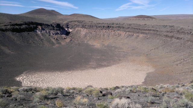
lunar crater
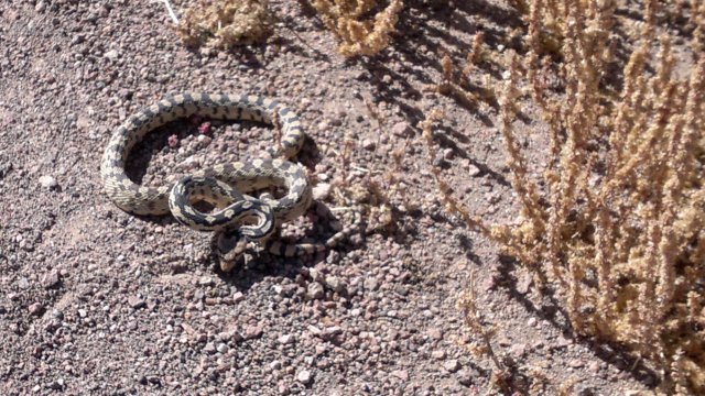
rattlesnake along road to lunar crater, riled up because I was pushing him off the road so he wouldn't be run over by a car (mice are my enemy and snakes are the enemy of mice and the enemy of my enemy is my friend)
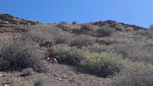
young coyote near hot creek ranch, won't live long if he doesn't learn to fear humans more
Wed, 10 Oct 2012 (57 miles in 5:02 hours)
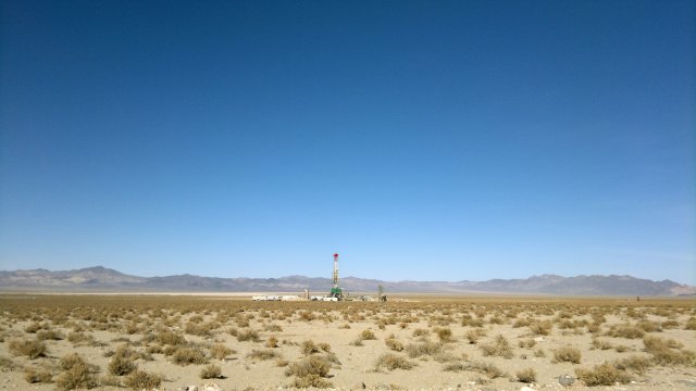
Light rain about 3AM and then light drizzle in the morning while packing up. Ominous storm clouds to the south as I rode down Stone Cabin Valley. Took the diagonal road past Stone Cabin Ranch to reduce the amount of travel on Highway 6. Rain began shortly after I began the descent from McKinney Tanks Summit, accompanied by a ferocious side-wind from the south. Tested the poncho, but it is a menance when traveling on a highway with cars whizzing past, and so stowed it and let myself get wet. Temperature in the 40's, but I can generate considerable heat while cycling, so not a problem. Poncho could work well while cycling on a gravel road, unless wind is truly awful. But need to add a loop to the rear to keep it in place against the nose of the saddle and perhaps thumb loops in the front. Deployed the tail light, since the black and grey color scheme of my clothes and bicycle are excellent for stealth camping but terrible for visibility in storm conditions. Checked into Tonopah Motel about 2PM, taking the last available room ($44 including tax, up from $38 including tax in the spring). Unless I'm mistaken, owners are the same as in the spring, but "for sale by owner" sign is no longer displayed and they appear cheerful rather than depressed. Tonopah has once again gone from bust to boom, at least temporarily, due to the solar power plant being developed north of town, and motels are all full with constuction workers. Checked the weather forecast: heavy rain tonight and tomorrow. So paid in advance for another night at the motel.
looking south along east stone cabin valley at the storm clouds heading north
Thu, 11 Oct 2012 (0 miles)
Piddled around watching the boob tube, reading magazines in the public library and eating junk food as it rained and rained outside.
Fri, 12 Oct 2012 (46 miles in 5:10 hours)
Rain stopped in the night, but cloudy in the morning, turning clear as the day went on. Conflicting forecasts as to today, but all forecasts agree that weather will be clear starting tonight and remain clear for several weeks to come. The storm that just passed came up from the Pacific over southern California. Puddles here and there in the desert, but gravel roads were solid. Poleline road north, then the road which forks right towards San Antonio ranch, then west towards the Cloverdale ranch, which is uninhabited. Camped just north of this ranch. Evidence of sheet runoff and flash flooding everywhere, so picked a high spot for my campsite, even though rain is unlikely tonight. Pitched the tarp using nail stakes, even though the ground is sandy, as they hold well in compacted as opposed to loose sand. High peaks of nearby mountains covered with snow from recent storm.
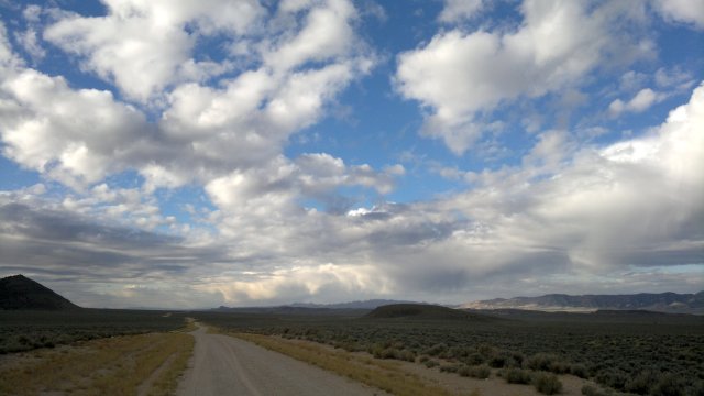
puddles in the desert along tonopah to gabbs poleline road
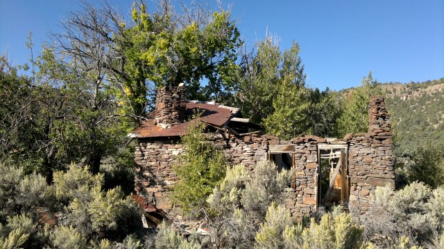
old cloverdale ranch
Sat, 13 Oct 2012 (40 miles in 5:46 hours)
No rain in night and cool dry breeze from north cleared up any dew on the tarp by morning. Cloverdale road north (plenty of campsites south of summit, not so many north of summit), then Grantsville road (plenty of campsites east of summit, not so many west of summit). Rangers at Berlin-Ichthysaur State park had guests and so opened the Ichthysaur exhibit for them after normal opening hours, and also allowed me in. Very interesting. Berlin is yet another mining ghost town, and not so interesting, at least not to me. Camped in the sagebrush in Ione Valley.
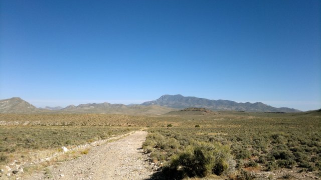
indian valley, with arc dome in the background, topped with recent snow
Sun, 14 Oct 2012 (71 miles in 7:04 hours)
Near freezing last night, with frosty dew covering everything in the morning. Highway 844 to get to Gabbs (very little traffic, especially early on a Sunday morning). Store and cafe both closed. Bar was open but not serving food. However, they did have some candy bars for sale and the bartender gave me a few bags of potato chips which normally accompany hamburgers. Filled up my bladders at the water faucet outside. Asked bartender and another woman inside about roads, and they agreed that Rawhide road was better than Gas Line road. So south on highway 361 for 11 miles, west on Rawhide road, north to Deadhorse well. Road atlas map shows a major gravel road heading southwest from Deadhorse well and then west towards Schurz, but this road was deep sand and appeared little used. So I continued north and took the same road I used to get to this area originally. Namely, the road which detours north of the National Mill mine and then runs past the old Rawhide site. As noted before, road atlas and Garmin 100K maps are both out-of-date and don't show the detour, which begins about midway betwen National Mill and Nevada Scheelite Mine as shown on the road atlas maps. This detour is a solid gravel road, so is hard to miss. Just fork right rather than left if heading west. If heading east (from Rawhide), the detour is the only option. Camped near old Rawhide site. Long day, but I wasn't pushing myself until near the end, when I had to press on to get past the National Mill mine. Just feeling energetic, maybe from all those candy bars.
car frame windmill, so-called because made from old ford chassis
drilling rig not far from car frame windmill
Mon, 15 Oct 2012 (47 miles in 6:00 hours)
Road atlas and Garmin 100K maps both show a road running south from Rawhide road to Pilot Cone Well, but this road is completely overgrown and sandy. So I continued on the Rawhide road, passing west of Red Ridge and then southwest towards Schurz. Sandy here and there, but mostly solid enough to pedal. Hopefully, someone will run a grader down this road now and then, so that it too doesn't get overgrown and sandy. Snacks at the Schurz convenience store. Refilled my bladders from the faucet outside. Rodeo Road to get to Weber Dam, then Julian Lane. Camped a few miles west of Weber Dam.
dawn near rawhide
Tue, 16 Oct 2012 (45 miles in 5:51 hours)
Continued along Julian lane to Highway Alt 95, then north along the dirt road which parallels the railroad running north up Adrian Valley. This dirt road is mostly solid. There is an unlocked gate where this dirt road reconnects with Highway Alt 95 near the Carson river. Since this road is through BLM land, it is public and the gate should never be locked in the future. After crossing the Carson River, west on Fort Churchill road. Camped about 5 miles east of highway 50, at the one point where access to the river is not blocked by fences. This area of public river access appears to be heavily used, so I concealed myself in the sagebrush, which is easy to do, since it grows high here and there is about 100 yards between road and river. Sure enough, some ATV's passed in the early evening and then someone came by in a pickup truck and spent an hour target shooting. In summer, especially on weekends, there will probably be rowdy parties here. At this time of year, on the other hand, especially on a weekday, everything quiets down once the sun sets, other than occasional hoofbeats and neighing of wild horses. Felt a little sick, perhaps because of all the junk food I ate at the convenience store yesterday.
duck-filled marsh in adrian valley, just north of julian lane and highway alt 95 intersection
Wed, 17 Oct 2012 (66 miles in 7:23 hours)
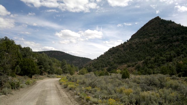
Continued along Fort Churchill road, crossed highway 50, Six Mile Canyon Road to Virginia City, Ophir Grade Road to Carson City. This is a much longer route, with lots of ups and downs (over 3000' of ascent) and some pushing on the rugged Ophir Grade dirt road, compared with simply taking highway 50 the 12 miles or so to Carson City. And probably no safer, since Six Mile Canyon Road has light traffic (other than during rush hours) but a narrow sloped shoulder and blind curves, whereas highway 50 has heavy traffic but a wide flat shoulder and open sight lines. However, the route described is that of the American Discovery Trail, and I wanted to try it so as to be able to comment about it.
From Carson City, I returned to Reno via the highway route, which has changed since I-580 opened. Use Combs Canyon Road to get past the hills norths of Carson City, since bicycles are not allowed on I-580. Turn right at Lakeview road and join up with old highway 395, which has light traffic now that most vehicles take the parallel I-580. Follow old 395 all the way to Reno. Just after the intersection with route 341 (aka Mount Rose highway to the west and Geiger Grade to the east), bicycles are diverted onto a bike path to the east of old 395. This bike path only runs for a hundred yards or so before exiting onto Old Virginia Road, which is very quiet. At Damonte Ranch road, turn right (east) and pass under 395, then left (north) at Double R Blvd, then right at Longley Lane, left at South Rock Blvd, and finally left at Mill Street, which leads to downtown Reno. All these roads just listed are busy, but all have bike lanes and no parked cars on the sides (so no risk of being "doored"). It is possible to avoid most of Mill Street by using Telegraph Street and the Greg Street bridge (with dedicated bike lane) cross the river and reach the Truckee River bike path. If going in the opposite direction (from downtown Reno towards Carson City), I would advise against using this Telegraph Street route, since it is difficult and dangerous to cross Mill Street here, due to lack of a traffic light. On the other hand, it might be possible to head north on Greg Street, then cross the river via the Rock Blvd bridge, if coming from downtown Reno and wanting to use the bike path, but I haven't tried this yet myself.
Checked into the same motel I used back in September. Too lazy to look for an alternative.
Final odometer 3726 miles.
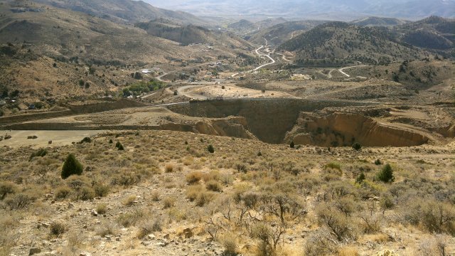
mining pit south of gold field, as seen from ophir grade road, note the railroad tracks running along the sheer face of the pit
Statistics
37 days total, of which 26 nights camping and 11 nights in motels. 1 rest day in Ely, 1 rest day in St George, 1 rest day in Tonopah, thus 34 days traveling.
1611 miles total and 199 hours of pedalling/pushing, Thus, for the 34 days of traveling, average of 5.9 hours/day, 8.1 miles/hour, 47 miles/day. Hours/day more than one hour higher than on Lassen tour, but average speed identical.
Comments
- Nalgene soap bottle cracked. This is the second time this has happened in about 10 years. I'm not sure what the problem is. Content is standard shampoo with conditioner and bottle is standard high-density polyethylene. Isn't this what shampoo bottles are normally made of? Does shampoo weaken polyethylene over time? Maybe I am putting pressure on the soap bottle without realizing it. In any case, I was carrying a spare 125ml bottle in case I decided to downsize from the 250ml chain cleaner bottle. So I used that spare for the shampoo. Probably should just replace the shampoo bottle every January. Cheap insurance against having shampoo spilled in my pannier.
- Hole in the bottom of the saddle bag from the chain tool rubbing through. What happened was that I didn't tie the saddle bag tightly enough to the bottom of the saddle, so it dragged against the rear rack. Metal rubbing against metal with cordura between will abrade the cordura in little time. Solution is to tie the saddle bag properly. Still, it wouldn't hurt to add reinforcement to the bottom of the saddle bag.
- Hole in bottom of nail stake stuff sack. I've been using this stake sack for years and it was inevitable that it would eventually get a hole. But it would be wise to add reinforcement to the new stake sack.
- Hole in side of right front pannier due to rubbing against front wheel quick-release nut. This would not happen with Ortlieb panniers, because Thorn racks are designed with Ortlieb panniers in mind and so there is just enough space between nut and Ortlieb panniers to avoid rubbing. What I need to do is add several layers of reinforcement to the front pannier. Then replace these reinforcement patches as they become abraded. It took over 60 days and 2000 miles of usage for this hole to develop in the current single-layer fabric. With two layers of reinforcement patches on top of the base fabric, I would probably only have to replace the patches once a year.
- Hook-and-loop straps coming unstitched from top of front panniers. Need to attach with more lines of stitching and use more fray-check.
- Abrasion where handlebar bag rests against accessory bar. Need to add two reinforcement patch. As with front panniers, use two layers and replace every year or so.
- Rear brake cable get stuck between handlebar bag and accessory bar, possibly causing damage to brake cable housing. Need to shorten the housing so this doesn't happen.
- Front panniers were designed with aluminum rods running through a tunnel as support, probably because such support is required for the handlebar bag and I was thinking of the handlebar bag when I designed the front panniers. The aluminum rods wore a hole through the tunnel, so I experimented with using the front panniers without them, and that worked fine (though stitching on straps began to come undone, as noted) and so I discarded the rods.
- Aluminum rods are required for the handlebar bag and will inevitably abrade the tunnel over time. So I need to come up with a design to prevent this, such as putting a bend into the rods.
- Flap of fabric in Ortlieb rear panniers is starting to show abrasion from bolts used to attach bag to plastic panel. Two options: (a) sew a piece of cordura on top of this flap; (b) add an open-ended cordura sack as a liner to the Ortlieb pannier. Cordura sack can be used in two orientations and thus would last longer, and also protects contents from outer bolt (which attaches a hook, for which Ortlieb provides no shielding).
- Garmin Etrex 20 proved essential (though maps have many errors) and Nokia N8 would not be an adequate substitute, since it lacks true GPS features (like setting map datum and showing position in either lat-long or UTM coordinates). Since I already own a Foretrex 301 (which I use for backpacking) and it weighs only 60 grams without batteries, bring that along on future bike tours in case the Etrex 20 breaks. Use the AAA batteries in the tail light (or the AAA battery in my flashlight plus the spare AAA battery in my repair kit) to power the Foretrex 301 if it is ever needed.
- Questions concerning bedbugs: (1) can bedbugs, especially the smaller nymphs, pass though the no-see-um netting of the bugbivy? (2) assuming they can't pass through, can bedbugs nevertheless bite through the netting? (3) can bedbugs lay eggs that pass through the netting? (4) how hot does water have to be to kill bedbugs and their eggs? (5) how to clean bedbugs and eggs from the bugbivy if no hot water available or water isn't hot enough? [Update: Most bedbugs can still be killed by permethrin, so this might be a reason to reevaluate my decision to no longer treat the bugbivy with permethrin, as discussed on the shelter page. There are reports of bedbugs beginning to develop resistance to permethrin. Bedbugs and their eggs are killed by exposure to water heated to 118°F (48°C). Water heaters in the United States are typically set to between 120°F and 125°F (49°C-52°C), so simply soaking an item in hot water or washing in hot water will kill all bedbugs and their eggs. The hot setting on dryers is also more than 118°F, so drying for 30 minutes of so should kill all bedbugs and their eggs. Note that items must be dry before their temperature will rise to that of the air in the dryer.]
- Bugbivy sack stuff sack is falling apart. I designed it too small and the buttonhole has broken due to stress. No-see-um netting on the bugbivy is also showing signs of wear-and-tear, probably because I perform my morning yoga exercises while sitting and standing on this netting.
- Pinhole leaks in two of the four MSR Dromedary bladders. One of these bladders also appears to have a leak where the plastic opening connects to the fabric—the same problem I had with the Dromlites long ago. I will try to fix with McNett Seamgrip. Seamgrip is polyurethane, and bladders are constructed of polyurethane-coated nylon, so hopefully this will work. MSR website says the polyurethane lining is "food-grade". I'm not sure to what difference between Seamgrip and food-grade polyurethane. I definitely need a strategy for fixing these bladders in the field. Seamgrip would be perfect, since I currently carry a 1/4oz tube of seamgrip in my repair kit.
- I experimented with pushing the bike through deep sand while loaded and unloaded, and it is substantially easier to push while unloaded. This provides yet another reason to go with the rack bag with straps, since I would then be able to put heavy items (water and food) in the rack bag and carry that on my back, while putting lightweight items (clothes, tarp, bug-bivy) in the panniers, thereby greatly reducing the weight of the bike and making it easier to push through long sections of sand. Probably could remove the hip strap and otherwise rework the rack bag design, however.
- Experiment with removing a link from the chain and then turning the eccentric bottom bracket towards maximum looseness, so I'll know how to do this in the field. Then put on a new chain. Chain works harder than just about any other part of my bike. I don't want to push my luck by trying to extend its life too far.
- Add lens cleaners to packing list, or perhaps a small bottle of rubbing alcohol in my toiletries kit. Something to clean camera lens. Rubbing alcohol would also allow removing pine sap from clothes.
- In case of rain/snow, smart thing is to go into hibernation until weather is clear again and roads have dried out. Need to always carry extra food to allow for this.
- Possibly add loop to rear bottom hem of poncho to secure to saddle, and thumb loops to front bottom hem, to better support biking with poncho.